Agricultural applications
Precision data collection to help maximize your harvest
Visible
Provides detailed imagery of your land.
Multispectral
Utilizing specialized cameras to provide greater insight to crop health
Topographical
Stereoscopic imaging to see detailed elevation changes.
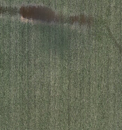
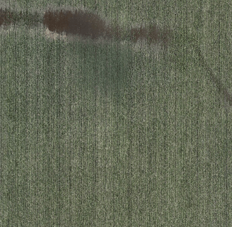
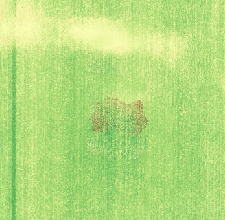
Visible Orthophotos
Description
As part of a normal data collection, images are processed into one contiguous image that is corrected to provide a true "top down" view.
These images typically have a positional accuracy of about 2-5 cm* and have a resolution of 2 cm or more, depending on requested detail level.
*2-5 cm positional accuracy is only available in states with public NTRIP/CORS networks, such as MN and WI.
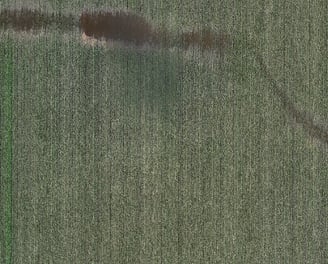
Notes
In this image, you can see the large brown spot at the top, which is suggestive of poor plant growth.
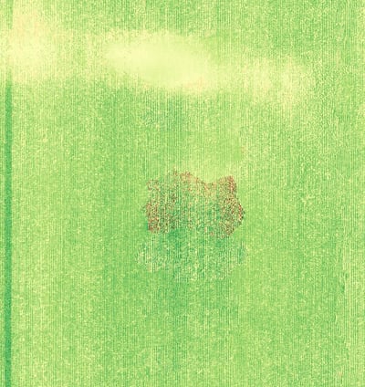
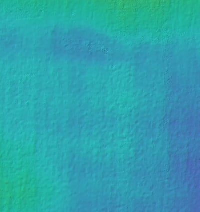
Multispectral Orthophotos
Description
For agricultural work, special camera filters and processing is used to show the Normalized Differential Vegetation Index (NDVI) for each pixel. This allows for a more standardized visualization of relative plant growth.
Much like the standard orthophotos, these images typically have a positional accuracy of about 2-5 cm* and have a resolution of 2 cm or more, depending on requested detail level.
*2-5 cm positional accuracy is only available in states with public NTRIP/CORS networks, such as MN and WI.
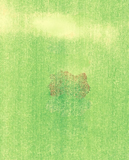
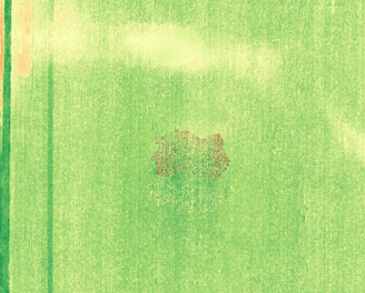
Notes
In this image, the brown spot from the previous orthophoto is still apparent. Additionally, a large area of localized flooding (red) becomes visible. The darkness of the shade of green correlates to a higher NDVI score, indicating healthier vegetation.
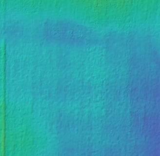
Topographic Mapping
Description
To facilitate proper drainage, it's important to know the lay of the land.
By using photogrammetric image analysis, a detailed topographic map can be generated, capable of illustrating differences in elevation down to 1.5 cm. This can help guide planning for drainage systems. For best results, it is recommended to collect data prior to plant growth, as such growth may interfere with results.
While not as precise as LiDAR, photogrammetry offers a good alternative for a much lower price.
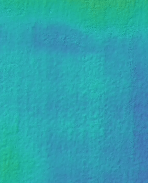
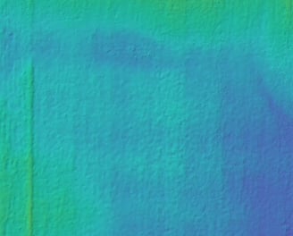
Notes
In this image, low spots show up as darker blue. The previously identified areas of poor vegetation growth and flooding correlate with low spots in the field as identified by topography.
Serving Southeast Minnesota and surrounding states
Photography Videography Agriculture Mapping
sierra2drones@gmail.com
© 2025. All rights reserved.